


What is a Plat Map? Here’s What You Need to Know
Plat maps offer important information about your property and the surrounding area. Find out how to read them and what to look for. The post What is a Plat Map? Here’s What You Need to Know appeared first on Redfin | Real Estate Tips for Home Buying, Selling & More.


A plat map is a legal document that shows how a piece of land is divided. It outlines property boundaries, lot dimensions, nearby streets, easements, and other key features. These maps are created by surveyors and used by local governments to keep track of land ownership and development.
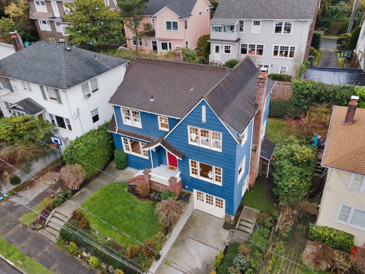
Homebuyers typically receive a plat map during the closing process. It may seem like just another piece of paperwork, but it’s important to review it carefully. Mistakes or misunderstandings about your property lines can affect everything from fencing to future construction. So whether you’re hunting for homes in San Jose, CA, or getting ready to close on a house in Philadelphia, PA, this Redfin article outlines everything you need to know about plat maps and how to read them.
What is a plat map and how is it different from a plot map?
A plat map details a collection of plots in a single area and how that land is divided. A single plat map can vary in size, showing a handful of properties, a neighborhood, or an entire town or county. Plat maps can also be used to determine property lines and land use, such as your ability to build other structures on the property.
Plot maps detail a single plot of land. Think of it as a close-up on just the land you’re buying. You’ll see where existing structures fall, boundary measurements of your plot, and any rights of way.
It’s important to note that not all properties are platted, so a plat map may not always be available. Plat maps can also be changed and updated, so always be sure you’re looking at the most recent available data.

What does a plat map show?
Reviewing your plat map should offer you exact information about your property, including:
Orientation: This refers to the land’s relationship to the cardinal directions (north, south, east, and west). Orientation is important for understanding how the sun will fall across your land and its structures — is it sun-soaked or sun-starved?
Land size: Your boundary lines and their measurements. The square footage of the plot should be listed and the land size should match what the seller has stated.
Flood zones: Your flood zone affects your home insurance rate, resale value, and where you can build new structures. It’s not necessarily a bad thing to buy in a flood zone, but you should be aware of the flood zone(s) that fall on your property.
Open spaces: Also known as “greenbelts,” these areas are natural lands meant to preserve wild areas. They may be recreational parks, preserves and reserves, wetlands, or wildlife refuges.
Recreational areas: This is your area’s parks, playgrounds, and sporting facilities like soccer or baseball fields.
Monuments: To correctly survey land, governments have boundary points or markers, called monuments, that are often placed in concrete along roads to indicate a property’s boundary points.
Easements: Easements show parts of an area that the public, the government, your neighbors, or private companies have access rights to. They modify your rights as a property owner, so be sure you understand any easements on your land.

Types of plat maps and when you’ll need them
As a homeowner, you may need one or more types of plat maps, depending on your situation. Here are the five types you might encounter:
Plat of subdivision
Records how a tract of land is divided into smaller parcels.
When you need it: If you’re buying one of the smaller parcels or if you’re purchasing a large tract of land that you plan to subdivide.
2. Short plat
Similar to a plat of subdivision but for no more than four separate parcels of land.
When you need it: If you’re buying up to four separate parcels.
3. Plat of consolidation
Combines several adjacent parcels into one larger tract of land.
When you need it: If the previous owner bought several parcels now selling to you, or if you’ve purchased additional parcels.
4. Amending Plat
Records changes or corrections to an existing plat map.
When you need it: If there have been any natural or manmade changes to the property.
5. Vacating plat
Legally cancels an existing plat map.
When you need it: If you need to nullify an existing plat map for any reason.
If you’re unsure about the type of plat map you need, your real estate agent, lender, and local municipality can offer guidance on the right plat map(s) for your home.

Why is a plat map important?
A plat map can affect your property in several important ways:
1. Property boundaries
Plat maps help confirm exactly what land you’re purchasing. If a fence, shed, or driveway crosses into a neighbor’s lot, a plat map can help resolve disputes.
2. Easements
You might not be able to build on part of your land if there’s an easement for things like utility lines, stormwater drainage, or shared driveways. Plat maps help identify these areas upfront.
3. Zoning and land use
If you’re planning to build an addition, install a pool, or subdivide the land, your local zoning office may refer to the plat map to determine what’s allowed.
4. Future planning and resale
Understanding your lot layout and access points can make it easier to plan improvements—or explain your property to future buyers.
When do you receive a plat map?
You’ll usually receive a plat map during the closing process when buying a home. It may be part of the title report or included in your survey documents. You can also request a copy from your local planning or assessor’s office, or search online if your municipality provides public access.
How to read a plat map
When you get your plat map, locate the symbol legend. This will help you read everything correctly, and it’ll show you how to find the monuments in your neighborhood. You should also locate the directional arrow (pointing north) and the scale, typically located near each other in the top left or top-right corner of the map.
The plots are more or less rectangular boxes following roads and marked with lot numbers in the middle. Below the lot number is the lot size, written in square feet. The parcel number will be listed in smaller numbers within the plot boundary, and the house number will appear just outside your plot boundary along the street line.
FAQs about plat maps
How accurate are plat maps?
The accuracy of your plat map depends on how recently it was updated. If the plat map you’re using was created within the past five years, you can rely on it to be mostly accurate. However, older maps are more likely to have discrepancies due to weather events and other changes. A survey of the property can ensure accuracy.
What’s the difference between plat maps and plot maps?
The primary difference between plat maps and plot maps is the scope they cover. Plat maps show a larger area of land and include multiple lots. Plot maps, on the other hand, only detail one lot.
When would you need a plat map?
You first receive your plat map during the closing process when you buy a home. You’ll want to pay close attention to the plat map during this process because what it says determines what you’re buying. You’ll need the plat map again if you refinance your home, request a building permit, or if you plan to subdivide your lot.
When closing on a home, you’ll use the plat map to verify the property in your sale. The plat will show the lot’s dimensions with the legal property lines. You’ll want to ensure that:
How do I find a plat map of my property?
There are several ways to get your plat map, depending on the type of map you need and the reason for getting it. You can obtain the map from:
- Your local government, either the city records office or county assessor’s office.
- The Bureau of Land Management (BLM), if you need a plat map for federal lands.
- Your title company provides the plat map among the documents you get as a result of your title search.
Do you need a property survey?
If the property’s plat shows any easements or encroachments, you should order a property survey from a licensed surveyor. You should also order one if there has been any recent land movement or flooding, as this could affect property lines, topography, and any easements.
The post What is a Plat Map? Here’s What You Need to Know appeared first on Redfin | Real Estate Tips for Home Buying, Selling & More.